Disclosure: Some links in this post are affiliate links. As an Amazon Associate I earn from qualifying purchases, at no extra cost to you. Learn more
Specs are compiled from manufacturer listings and verified buyer reviews and can change over time — please confirm the key details on the product page before buying.
If you need a position you can actually trust when the trees close in and your phone shows one grey bar, buy the Garmin GPSMAP 67. It is the strongest all-round pick here for accuracy, with multi-band satellite reception and up to 182 hours of battery life. If you are surveying property lines to the centimetre, the RTK kits further down are the real tools. The rest of this page walks you through who each device actually suits, in plain terms.
This guide is built by comparing the manufacturers’ published specifications and the patterns across verified customer reviews, so you get each pick’s real strengths and trade-offs instead of marketing spin.
Below you will find handhelds for hiking and hunting, a watch for trail runners, and professional survey receivers for civil engineering and topography work. Whether you are marking a boundary or finding your way back to the trailhead, this breakdown of the high accuracy gps device market covers what each unit truly does.
Top Picks


How To Choose The Best High Accuracy GPS Device
The single biggest mistake buyers make here is assuming the number on the box tells the whole story. A “five-foot accuracy” claim from a phone or a cheap handheld often collapses the moment you walk under dense canopy or into a canyon. Real accuracy comes from the satellite technology inside the unit, not from a marketing line.
Multi-band reception is the real accuracy lever
Multi-band GNSS (global navigation satellite system — the network of satellites broadcasting position signals) lets a receiver listen on more than one frequency at once. That means it can correct for signal bounce off buildings and trees. A unit with multi-band reception holds a fix where a single-band device drifts. This is the spec that separates a hiking gadget from a trustworthy navigation tool.
Decide between feet and centimetres before you spend
Handhelds and watches give you accuracy measured in feet. Professional RTK (real-time kinematic — a correction method that refines a position to centimetre level) kits give you accuracy measured in centimetres. If you are finding your way back to a campsite, feet are plenty. If you are staking a boundary or setting drone ground control points, you need RTK.
Battery life in the field is not the same as battery life on a desk
A handheld rated for 16 hours may give you that with intermittent use, not continuous screen-on time. Look at whether the battery is user-replaceable, whether it charges over USB-C, and how the listed hours compare to how you will actually use the unit. Backcountry users should also check whether the device runs on standard AA batteries, which you can carry as spares.
Side-by-Side Comparison
| Model | Best For | Satellite Accuracy | Battery Life | Display Size | Amazon |
|---|---|---|---|---|---|
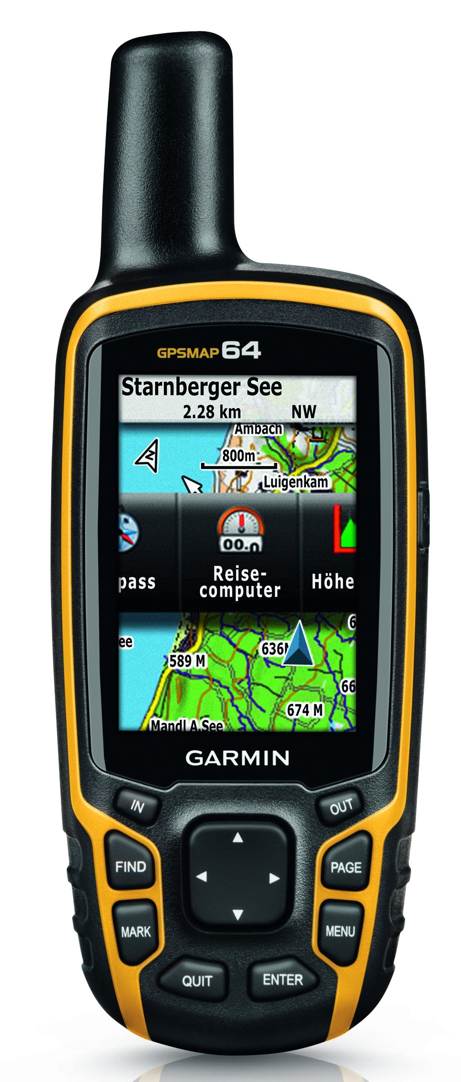
| Garmin GPSMAP 64★ Best Overall | Budget-friendly handheld basics | GPS + GLONASS | 16 hours | 2.6″ | Amazon |
| Garmin GPSMAP 67Also Great | All-round backcountry accuracy | Multi-band GNSS | Up to 182 hours | 3″ | Amazon |
| Garmin GPSMAP 65Best for Multi-Band | Button-operated multi-band hiking | Multi-band GNSS | 16 hours | 2.6″ | Amazon |
| Bushnell BackTrack Mini | Lightweight backup navigation | GPS waypoint tracking | Up to 35 hours | Not specified | Amazon |
| Bad Elf Flex Mini | Boosting tablet or laptop GPS | 1.5–2m accuracy | 24 hours | Not specified | Amazon |
| Suunto Vertical 2 | Trail running and multi-day adventure | Dual-band GPS | Up to 65 hours training / 20 days watch | 1.5″ AMOLED | Amazon |
| SingularXYZ E1 Lite | Professional RTK surveying on a budget | 1cm RTK | 20 hours | 5.45″ collector | Amazon |
| SMA26 Plus | Civil engineering and topography | 1cm RTK | 20 hours | 5.45″ HD collector | Amazon |
| SingularXYZ E1 | High-precision RTK with long radio range | 1cm RTK | 20 hours | 5.45″ collector | Amazon |
Detailed Reviews
1. Garmin 010-01199-00 GPSMAP 64 Worldwide
Our pick — 4.5+★ from 450+ verified ratings; the strongest balance of quality and price.
An aging classic that still earns its place on the trail.
This is the “old standby” for dirt bikes and dual-sport riders, and it has aged into a straightforward value pick. It pairs standard GPS with a GLONASS receiver (GLONASS is Russia’s satellite network — the second constellation it can listen to). Dual radios help lock a signal harder to reach than GPS alone. The 2.6″ colour display is sunlight-readable, so you can follow a track without shading the screen.
The battery system is the smart part for cold-weather trips. It runs on two traditional AA batteries, or you can drop in an optional rechargeable NiMH pack that charges while inside the device. That means you can carry cheap spares instead of hunting for a wall socket. The 4GB of internal memory keeps room for maps, and it takes microSD cards. Weight is 8.1 oz (230 g) with batteries.
It is not a multi-band device, and that shows in the numbers. The rated battery life is 16 hours, versus the 182 hours of the GPSMAP 67 above. It also lacks Bluetooth in this base version, which is the one thing some owners wish they had. If you want a rugged, simple AA-powered tracker for a bike or a hike, it still does the core job well. Signal quality is the thing owners praise most, and the durability holds up to years of use.
The AA advantage: A user-replaceable power system makes this one of the best choices for cold-weather trips where rechargeable units fade.
The honest gap: No multi-band reception and no Bluetooth put it behind the newer picks for holding a fix in dense cover.
Best fit for: riders and hikers who want simple navigation plus swappable batteries.
Think twice if: you need Bluetooth syncing or the tightest accuracy in thick timber.
2. Garmin GPSMAP® 67, Rugged GPS Handheld
The handheld that keeps its grip on satellites when the canopy closes overhead.
This is the pick that nails the core job: holding a fix where cheap units give up. The GPSMAP 67 uses expanded GNSS (global navigation satellite system — the satellite network that beams position signals down to you) with multi-band technology. Multi-band means it listens on more than one frequency, so it can correct for signal bounce in steep country, urban canyons, and forests with dense trees. Buyers report it holds a fix to within 5 feet even under dense canopy.
The battery tells its own story. You get up to 182 hours in standard mode, and up to 840 hours in expedition mode. The GPSMAP 64 further down the list is rated at just 16 hours, so the 67 lasts more than 11 times as long on paper. Its 3″ sunlight-readable colour display also beats the 64’s 2.6″ screen by about 15% in area. That extra room matters when you are squinting at a map in bright sun.
The other tools make it a genuine field instrument. There is a 3-axis compass and a barometric altimeter for altitude readings. You get active weather with animated radar, plus Geocaching Live syncing when paired with your phone. The catch is the learning curve. The interface is not beginner-friendly, and a few users call it complicated next to a phone. It is also built on buttons, not a touchscreen. Plan on a few hours of practice before you trust it on a real trip.
Where it pulls ahead
- Multi-band GNSS holds accuracy in steep country and dense tree cover
- Up to 182 hours standard, up to 840 hours in expedition mode
- 3-axis compass and barometric altimeter built in for real field work
- Active weather radar and Geocaching Live with a paired phone
Where it asks patience
- The interface carries a real learning curve for first-timers
- Buttons only, so no touchscreen navigation
- Premium mapping content needs an Outdoor Maps+ subscription
Reach for this if: you want the most accurate handheld here for multi-day backcountry trips, and you will put in the practice time.
Look elsewhere if: you want a plug-and-play phone-like experience on day one.
3. Garmin GPSMAP 65
Multi-band accuracy in a simpler, button-first package.
If you like the sound of the GPSMAP 67’s accuracy but want a smaller step up from a basic handheld, the GPSMAP 65 is the middle path. It brings the same expanded GNSS and multi-band technology for “optimal accuracy in challenging locations, including steep country, urban canyons and forests with dense trees.” The 2.6″ sunlight-readable colour display keeps the button-first feel familiar.
The maps are a genuine draw. It ships with routable TopoActive mapping and a federal public land map for U.S. users. If you work or explore on public land, those boundaries are already loaded. It pairs with the Garmin Explore app to manage tracks, routes, and waypoints, and you can review your field stats from the app. Battery life is rated at 16 hours.
Buyers keep praising how well it works, and geocaching and general reliability come up again and again. One owner who uses it in archaeology calls it “one of my favorite tools, use it all the time.” The learning curve is real, though: it is not plug-and-play, and some users lean on YouTube tutorials to master it. Once you climb that hill, you get a compact, well-built navigation backup. It offers multi-band reception (it listens on more than one satellite frequency band, so the fix holds steadier) in a smaller, simpler build than the GPSMAP 67.
The map payoff: Routable TopoActive maps plus federal public land boundaries mean less map-loading before a trip.
What it lacks: The 16-hour battery and 2.6″ screen fall short of the GPSMAP 67’s 182 hours and 3″.
Pick it for: geocachers and public-land hikers who want multi-band accuracy without the 67’s price.
Avoid if: you need long expedition battery life or a bigger screen.
4. Bushnell BackTrack Mini GPS Navigation

A pocket-size breadcrumb unit for finding your way back to base.
This is a different animal from the Garmin handhelds. The BackTrack Mini is a bare-bones waypoint tracker, built for the case where your phone dies or loses signal on the trail. It captures your trip or a waypoint and guides you back to your starting position. Battery runs up to 35 hours, and it charges over Micro USB, so no expensive batteries are needed.
It disappears into a jacket pocket, and one buyer who keeps it as a backup calls it “small, light and easily packs away in a small pocket.” You get elevation gain and decline, barometric pressure (air pressure, which tracks weather and altitude), sunrise and sunset, and moonrise and moonset. The large glove-friendly buttons are a thoughtful touch for cold hands.
The trade-off is that this is a backup tool, not a primary navigator. The app is the weak point. Its core features lean on the Bushnell Connect app, and some users find the app unreliable. Buttons are stiff and the display is small, and one can spot distance overestimates. If you want a full topo map and route planning, this is not that device. If you just want a pocket safety net to retrace your steps, it does that job at a low weight.
What it does well: Captures waypoints, shows elevation and barometric pressure, and runs up to 35 hours on a Micro USB charge.
The weak spot: Its app is the main function path, and usability and accuracy are mixed points for some users.
Good match for: a lightweight backup in your pack for retracing a trail or finding basecamp.
Not the right tool for: route planning, topo maps, or anyone who relies on the phone app.
5. Bad Elf Flex® Mini Standard GNSS Receiver
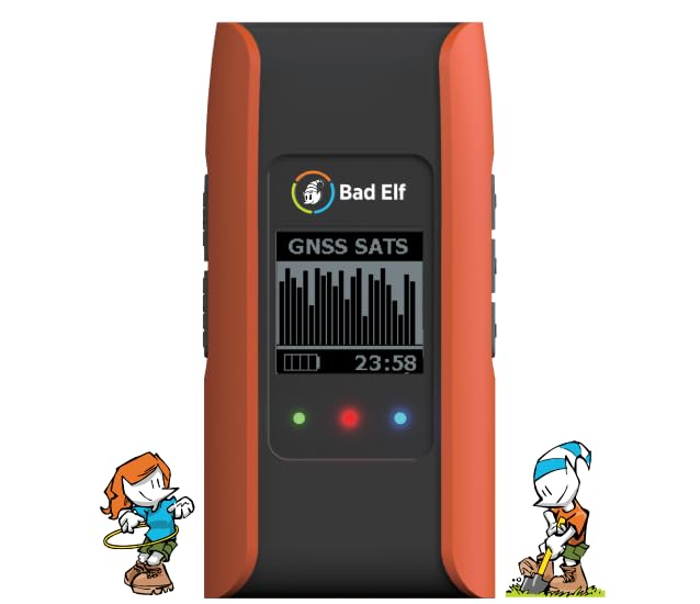
It gives your tablet a real GPS, not the drifting built-in one.
This is not a standalone navigator. It is a Bluetooth receiver that feeds clean position data to a tablet, phone, or laptop. In SBAS regions (SBAS is a ground-based correction system that sharpens satellite signals), it claims 1.5–2m accuracy. It talks to iPhone and iPad as an iOS certified accessory, and it also works with Android and Windows. A magnetic base lets it mount on a hatch, as one sailor does for constant signal on the water.
The accuracy improvements show on the water and in the air. Sailboat users say it fixes the iPad’s inaccurate internal GPS and the fix loss that makes navigation unreliable. Helicopter pilots like the steady 1-second logging and the readout of horizontal and vertical accuracy, speed, and elevation. You also get multiple output formats, and there is a field upgrade path to RTK services that reaches 1-foot or better accuracy. Battery life is rated at 24 hours.
The limits are in the software and the platform. A buyer on Android reports the unit is not for Android in practice, and a couple of users find the logging options thin, with no logging rate adjustment at the time of writing. Bluetooth connectivity gets mixed reports. If you want a mouse-size Bluetooth receiver that gives a tablet trustworthy position data for mapping and tracking, it earns its keep. Multi-constellation speed and no drifting are its selling points.
Why it earns a slot: Real accuracy gains over a tablet’s internal GPS, with 24-hour battery life and a field upgrade path to RTK.
The honest caveat: Its logging options are limited and English-Android experience is spotty, so check the app before you commit.
Made for: people who want accurate iPad or laptop position data for mapping, tracking, or marine navigation.
skip it if: you need a standalone screen-and-maps handheld you can navigate from directly.
6. SUUNTO Vertical 2 GPS Sports Watch
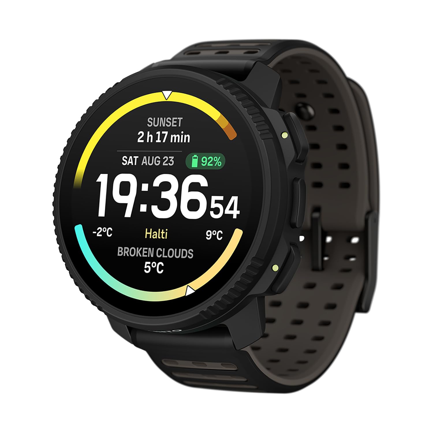
A trail watch that tracks the route and lasts the week between charges.
If you want GPS accuracy on your wrist and do not want to recharge every night, the Vertical 2 is built for that life. Dual-band GPS lets it lock position across more satellite signals, which helps in canyons and under tree cover. It gives up to 65 hours of training time in best GPS mode, and 20 days of smartwatch use. That means a multi-day expedition or a week of daily runs without a charger. The 1.5″ AMOLED touchscreen is a bright, colour display.
For trail work you get ClimbGuidance and route adjustment on the go, so you can reroute without pulling out a map. There are 115+ sport modes, taking in trail running, backcountry skiing, and plain hiking. The build is titanium or stainless steel depending on the version. Battery life is the loudest praise point, with owners noting they charge every two to three weeks. GPS performance is what earns the most favourable mention.
The catch is the interface. Some users find it confusing to operate, and the heart-rate sensor gets mixed reports on lag. The steel version is substantial but large on the wrist, and one delivery arrived with a power-on problem. If you want wrist-based mapping and tracking that runs for weeks between charges, this is a strong option. If you want a simple fitness band, it may be more watch than you need.
The long-haul edge: Up to 65 hours in best GPS mode and 20 days of smartwatch use means charging becomes an afterthought.
Where it asks more: The interface is not simple, and heart-rate readings lag for some users.
Belongs on your wrist if: you run trails, ski backcountry, and want GPS maps plus multi-day battery.
Pass if: you want a simple, easy-to-read fitness band and nothing more.
7. SingularXYZ E1 Lite GNSS RTK Surveying Equipment
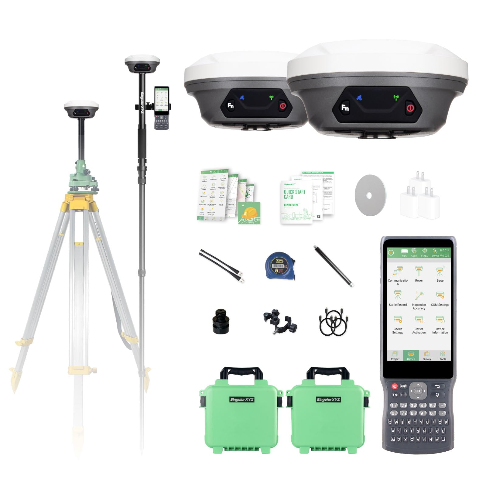
Survey-grade centimetre fixes without the flagship price tag.
This is where the article shifts from hiking to real surveying. The E1 Lite is a base-and-rover RTK kit that produces 1cm accuracy, with a 1408-channel receiver. RTK (real-time kinematic) is a correction method that refines a raw satellite fix down to centimetres, using a base station and a moving rover. The 60° tilt survey function initialises in 5 seconds, so you can measure a point without holding the pole perfectly level. It works with regular 5/8″ thread poles (poles not included).
Range and endurance are the field specs that matter. The radio link between rover and base reaches 10–15 kilometres (6.21–9.32 miles), and it can also pair with other brands’ base stations in Radio or CORS mode. A 6700mAh battery gives 20 hours of continuous operation, with fast Type-C charging. The full-constellation tracking takes in GPS, GLONASS, Galileo, BDS, QZSS, IRNSS, and SBAS, so it can fix a solution in seconds even with multipath or tree cover.
The kit includes the SC260 data collector with Android 11, a 5.45-inch sunlight-readable screen, an 8-core CPU, 64GB of storage, and an 18H battery. Total system weight is 3.5 kg (7.72 lb). Support earns genuine praise, with one buyer reporting the team “went out of their way” to fix a password issue. The wild card is quality control: one user sent a unit back because it stopped connecting after the second use. U.S. users must apply for an FCC radio license for commercial UHF use. When it holds a connection, it delivers 1cm RTK fixes all day.
Survey-day strengths
- 1cm RTK accuracy with 1408 channels for tight field measurement
- 60° tilt survey initialises in 5 seconds to save setup time
- 10–15 km radio range, plus other-brand base compatibility
- 20 hours of continuous operation on a 6700mAh battery
Field-day cautions
- Poles, tripods, and tribrach are not included
- U.S. commercial UHF use needs an FCC radio license
- A stray unit has been reported failing early; buy from a seller with returns
Reach for this if: you need centimetre-level RTK for irrigation, boundary, or construction work without the top-tier price.
Look elsewhere if: you need guaranteed plug-and-play reliability with zero setup tolerance.
8. SMA26 Plus GNSS RTK Rover & Base Surveying Equipment

A fully integrated RTK kit that switches from base to rover in one device.
This is the flexibility pick among the professional kits. The SMA26 Plus is a full-constellation RTK GNSS receiver with wide protocol compatibility, so it works with multiple RTK brands. It supports PPP, PPK, and RTK technologies (PPP and PPK are post-processing correction methods; RTK is live). Tilt measurement reaches 2.5 cm at tilt angles of 30° or less, after a simple initialisation. The maximum tilt angle is 60°.
The rugged ratings are built for a worksite. It carries IP67 protection (IP67 means it is dust-tight and survives brief water immersion), and is drop-resistant up to 2 meters. It operates from -45℃ to +75℃, which covers extreme heat and cold. A 10000mAh battery gives up to 20 hours of continuous operation. The handheld collector runs Android 11 on a 5.45″ HD screen, with dual SIM, a 9000mAh battery, NFC, and a 13MP rear camera. Built-in storage is 32GB.
Owners who use it for archaeology report that the two-unit base-plus-rover setup (one unit stays put as a reference point, the other moves with you) takes minutes to configure, with clear on-screen prompts and helpful videos. Its tilt compensation, which corrects your position when the pole is not perfectly upright, gets called “a standout” for collecting data at walking speed. Support on WhatsApp answers in roughly a day. The honest caveat is in the instructions. One buyer returned a unit, saying practically no instructions were included and the setup was too hard to figure out. It also ships with a NOAA certification (a government-issued quality credential), a real credential for professionals who need verifiable quality.
What makes it pro-grade
- 1cm RTK accuracy with PPP and PPK support, NOAA certified
- IP67 protection and a 2-meter drop rating for rough sites
- Operates from -45℃ to +75℃ across extreme conditions
- All-in-one base and rover switching on a single device
Where the learning bites
- Instructions are thin, and some buyers need outside help to set up
- The collector interface takes real time to learn
- No poles or tripods in the box; budget for those separately
Right for you when: you run civil engineering or topography work and want one kit that covers base and rover.
Not ideal if: you expect a full printed setup manual and no support calls.
9. SingularXYZ E1 GNSS Survey Equipment
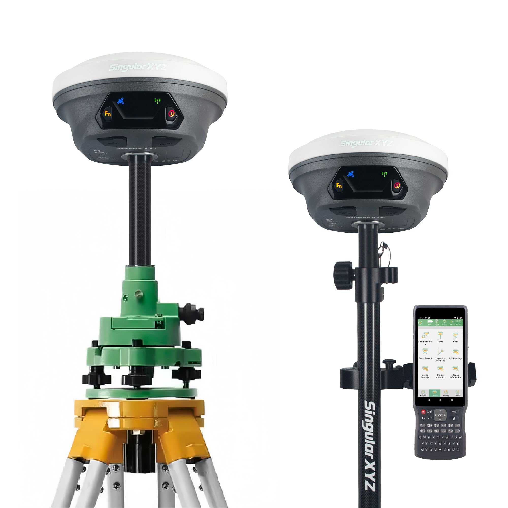
The longer-range revision of the E1 line, built for big open work sites.
This is the range leader between the two SingularXYZ kits. Where the E1 Lite reaches 10–15 kilometres, the E1 pushes the rover-to-base radio range out to 15 kilometres (9.32 miles). It still handles RTCM v3 and CMR correction data, and it can work with other brands’ base stations in Radio or CORS mode. The 60° tilt survey initialises in 5 seconds, and it fits regular 5/8″ thread poles.
The rest of the spec sheet matches the professional class. It runs 6700mAh for 20 hours on a single charge with fast Type-C charging, producing centimetre-level precision from a base and rover. Full-constellation tracking covers GPS, GLONASS, Galileo, BDS, QZSS, IRNSS, and SBAS, so it can fix a solution in seconds in multipath, trees, or city canyons. The included SC260 collector has a 5.45-inch screen, 64GB of storage, and an 18H battery. System weight is 3.5 kg (7.72 lb).
Value is the headline. Owners mention it does the job at a price far below the big-name brands, with one owner comparing it to Trimble kits at a fraction of the price. It works as a base for drone work, including NTRIP correction over Wi-Fi, and handles topos, boundaries, and stakeout. The catch is the same as its sibling: the written docs have gaps, and setup takes learned skill. One field user reported inconsistency after weeks and found the setup videos too fast to follow. Support, though, answers within a day by email or WhatsApp. U.S. commercial UHF users need an FCC license.
The value case: 15 km radio range, 1cm RTK, and a full collector kit at a price that undercuts the established brands.
What to expect: Setup is a learned skill, and the manual leaves gaps you will fill with support calls or community videos.
Worth it for: drone mappers, boundary surveyors, and site crews who need long-range RTK at a value price.
Look at a different pick if: you need complete documentation and want to skip support calls entirely.
Know the Specs
Multi-band vs single-band GNSS
GNSS (global navigation satellite system) is the overall satellite network. Single-band receivers listen on one frequency, while multi-band receivers listen on several. The practical result is fewer dropped fixes under tree cover, in canyons, and near buildings. If you hike or ride in thick timber, multi-band is the spec worth paying for.
What RTK actually means
RTK (real-time kinematic) is a correction technique that uses a fixed base station to refine a rover’s position to centimetre level. It requires a base and a rover, and it is the technology behind the 1cm accuracy figures on the survey kits. It is not needed for hiking or driving, but it is essential for boundary marking, drone ground control, and construction staking.
Battery hours and how to read them
Rated battery life is often measured with intermittent use, not a screen left on full brightness. A handheld listed at 16 hours may give a partial day of constant map viewing. Expedition mode on some Garmin units stretches life far beyond the standard rating. Check whether the battery is rechargeable or replaceable before you commit.
IP ratings and drop protection
An IP67 rating means the device is dust-tight and survives brief water immersion. A 2-meter drop rating means it is built to take a fall onto a hard surface. Both matter on a worksite or a wet trail. If you work outdoors in rain, mud, or dust, check these ratings before you look at display size.
Common Questions
Will a multi-band GPS fix faster than a single-band one under trees?
Do I need an RTK kit for hiking or trail navigation?
Can the Bushnell BackTrack Mini replace a full handheld GPS?
What does the Bad Elf Flex Mini do that my tablet cannot?
How long does the Garmin GPSMAP 67 battery really last in the field?
Is the Suunto Vertical 2 water-resistant for swimming or rain?
Do the SingularXYZ and SMA26 Plus kits include poles and tripods?
Do I need a radio license for the UHF function on survey kits?
Which device is best for finding property stakes across a wooded lot?
Will paired sensors and heart-rate monitors work with the Garmin GPSMAP handhelds?
The Bottom Line
For most people shopping for the best high accuracy gps device, the winner is the Garmin GPSMAP 67. It holds a multi-band fix in thick cover and lasts up to 182 hours, which covers a multi-day trip without a charger. If you want the same multi-band accuracy in a smaller, simpler package, the Garmin GPSMAP 65 is worth a look. And if you are doing centimetre-level survey work, the SingularXYZ E1 Lite brings 1cm RTK and a 15 km radio link to a value price.
How we choose
We do not accept paid placement. Every pick is matched to a real buyer and a real use-case; we do not hands-on test units.
Sources
Specifications: manufacturer listings and product documentation. Review insights: verified customer reviews, as of October 2026. Pricing: not shown on this page (it changes often); check the current price via the retailer link.
As an Amazon Associate, Aappliancez earns from qualifying purchases. This does not affect which products we feature.