Disclosure: Some links in this post are affiliate links. As an Amazon Associate I earn from qualifying purchases, at no extra cost to you. Learn more
Specs are compiled from manufacturer listings and verified buyer reviews and can change over time — please confirm the key details on the product page before buying.
You paddle out, the shoreline folds behind you, and your phone shows one bar that vanishes the moment the trees close in. A dedicated handheld keeps a satellite fix with no cell signal at all, and it runs on AA cells you can swap mid-lake. The right one for a canoe is waterproof, readable in direct sun, and honest about battery hours — so here is the short list, sorted by what matters on the water.
This guide is built by comparing the manufacturers’ published specifications and the patterns across verified customer reviews, so you get each pick’s real strengths and trade-offs instead of marketing spin.
Most canoeists do not need a chartplotter strapped to the thwart; they need a fix that holds, a screen they can read at noon, and spare cells in the dry bag. That is the lens for this shortlist of the best GPS for canoeing.
Top Picks


How To Choose The Best GPS for Canoeing
On a canoe you are sitting low, often wet, and usually wearing gloves by the second portage. That changes the checklist: buttons beat touchscreens once your fingers are cold and slick, and a body that floats beats one that merely resists splashes. Everything below is about surviving a long, wet day on the water, not about features that only look good in a store.
Battery hours and what powers them
A canoe GPS lives or dies on battery runtime and how you replace the cells. Look for a unit that runs on AA cells, because you can carry a spare pair in a dry bag and swap them in seconds on the bank. A quoted figure like 16 hours is your realistic window for a full paddling day, while 168 hours in standard mode means you could run a multi-day river trip on one set. Expedition mode on some units stretches that even further by sampling your position less often.
Water resistance versus floating
An IPX7 rating means the unit survives being submerged in water for a short period, which covers rain, splashes, and a quick dunk. That is not the same as floating. If you regularly paddle swift water or you tend to fumble a device while balancing a paddle, a model designed to float is the difference between a recovery and a loss.
Satellite systems and tree cover
Basic GPS alone can struggle in a narrow river valley with a heavy canopy overhead. Multi-GNSS support means the unit also listens to other satellite networks, and multi-band adds a second frequency for tighter accuracy. For most canoeists on open water and shorelines, standard GPS and GLONASS is plenty; for tight wooded channels, the extra constellations help you keep a fix.
Side-by-Side Comparison
| Model | Best For | Battery Life | Display | Water Handling | Amazon |
|---|---|---|---|---|---|
| Garmin GPSMAP 64sx★ Best Overall | All-round canoe navigation | Up to 16 hours | 2.6” color | Water-resistant | Amazon |
| Garmin eTrex SEEndurance Pick | Multi-day trips on AA cells | Up to 168 hours | 2.2” high-resolution | IPX7 | Amazon |
| Garmin GPS 73Waterproof Pick | Open-water and sailing crossover | 18+ hours | 128 x 160 pixels | Handheld marine build | Amazon |
| Garmin eTrex 22x | Preloaded topo maps on a budget | Up to 25 hours | 2.2” color | Handheld build | Amazon |
| Garmin eTrex Solar | Sun-powered long expeditions | Up to 200 hours | 2.2” high-contrast | IPX7 | Amazon |
| Garmin eTrex 32x | Topo maps plus a real compass | Up to 25 hours | 2.2” color | Handheld build | Amazon |
| Garmin GPSMAP 79s | Dropping it in the river | Up to 20 hours | High-resolution color | Floats, IPX6 unit-level | Amazon |
| Garmin GPSMAP 79sc | Coastal and tidal paddling | Up to 20 hours | High-resolution color | Floats, IPX6 unit-level | Amazon |
| Garmin GPSMAP 65s | Tight accuracy in wooded channels | Up to 16 hours | 2.6” color | Water-resistant | Amazon |
| Garmin GPSMAP 86Sci | Remote water and SOS backup | Up to 24 hours | 3” sunlight-visible | Floats | Amazon |
| Garmin eTrex 10 | Cheapest way onto a breadcrumb track | Up to 20 hours | 2.2” monochrome | IPX7 | Amazon |
Detailed Reviews
1. Garmin GPSMAP 64sx Handheld GPS
Our pick — 4.5+★ from 900+ verified ratings; the strongest balance of quality and price.
The paddling partner that keeps its fix under a full canopy of trees.
You get a 2.6-inch sunlight-readable color screen, and it is the largest display among the button-operated picks here. The quad helix antenna (a spiral aerial that pulls in weak signals) is why this one holds a lock where a cheaper unit starts to hunt for satellites.
Battery is quoted at up to 16 hours in GPS mode on AA cells. That is a full day of paddling with a comfortable margin, and because they are standard AA you can carry a spare pair and swap them on a gravel bar without hunting for an outlet. For comparison, the eTrex SE runs 168 hours in standard mode — a far longer figure — while this 64sx trades that endurance for the bigger screen and the sensor set. The high-sensitivity receiver listens to GPS, GLONASS and Galileo at once, so a narrow wooded channel is far less likely to blank your position.
The 3-axis compass and barometric altimeter round out what owners call the ABC sensors. A barometric altimeter (a pressure sensor that reads your elevation) gives you a stable height reading, and the compass keeps a heading even when you are standing still. Maps come preloaded with routable roads and trails, and you can add more via microSD. The honest friction here is the interface: button-driven menus take practice, and the crowded function set draws mixed reactions. Budget a slow evening with the manual before your first trip, and it stops being a puzzle.
What earns its place in the boat
- 2.6-inch sunlight-readable color display — the largest here among button units
- Quad helix antenna with multi-GNSS support for a fix under tree cover
- 3-axis compass and barometric altimeter for heading and altitude
- Runs on AA cells with up to 16 hours in GPS mode
Where it asks patience
- Button menus are dense — plan a learning session before the trip
- At 16 hours it trails the far longer endurance of the eTrex SE
- It resists water but is not built to float like the GPSMAP 79s
Grab this one if: you want the biggest, clearest screen and a true compass for mixed river and shoreline days.
Think again if: you are paddling a multi-day route far from resupply — the 168-hour eTrex SE is the safer endurance call.
2. Garmin eTrex SE GPS Handheld Navigator
Eighty hours of paddling on one pair of AA cells — that is the whole pitch.
The number to fix in your head is 168 hours in standard mode on two field-replaceable AA batteries, with expedition mode quoted at up to 1,800 hours. Set that against the GPSMAP 64sx at 16 hours and the gap is enormous: a week-long river trip where you never touch a charger becomes realistic. Expedition mode stretches it by sampling your position on a longer interval, so you give up a little responsiveness for days of extra runtime.
It listens to GPS, GLONASS, Galileo, BeiDou and QZSS — five satellite networks, which is the widest spread in this group. In practice that means a fix holds better in the awkward places: a shaded side channel, a cliff-lined bend, a portage through dense scrub. The 2.2-inch display is high-resolution and readable in bright sun, and the digital compass plots a bearing even while you are standing still on a rock.
Pairing with the Garmin Explore app on your phone is where this unit gets clever. You plan trips, pull in weather, get software updates wirelessly, and pull in extra mapping on the phone’s larger screen. The on-device map is thin by itself, so the phone pairing is not optional garnish — it is how you get real map detail. What wins people over is the quality of the build and that battery figure together. The recurring gripe is the menus: they are the classic Garmin button maze, and the buttons need a firm centre press. A day of practice smooths it out.
Runtime worth planning around: a quoted 168 hours in standard mode means you can leave the power bank at home and pack spare AA cells instead.
Phone is part of the kit: on-device mapping is limited, so bring a charged smartphone paired to the Garmin Explore app for the trail map view.
Built for: the paddler running multi-day routes who wants to forget about charging entirely.
The catch: the button menus and stiff keys take real practice, and the map detail lives on your phone.
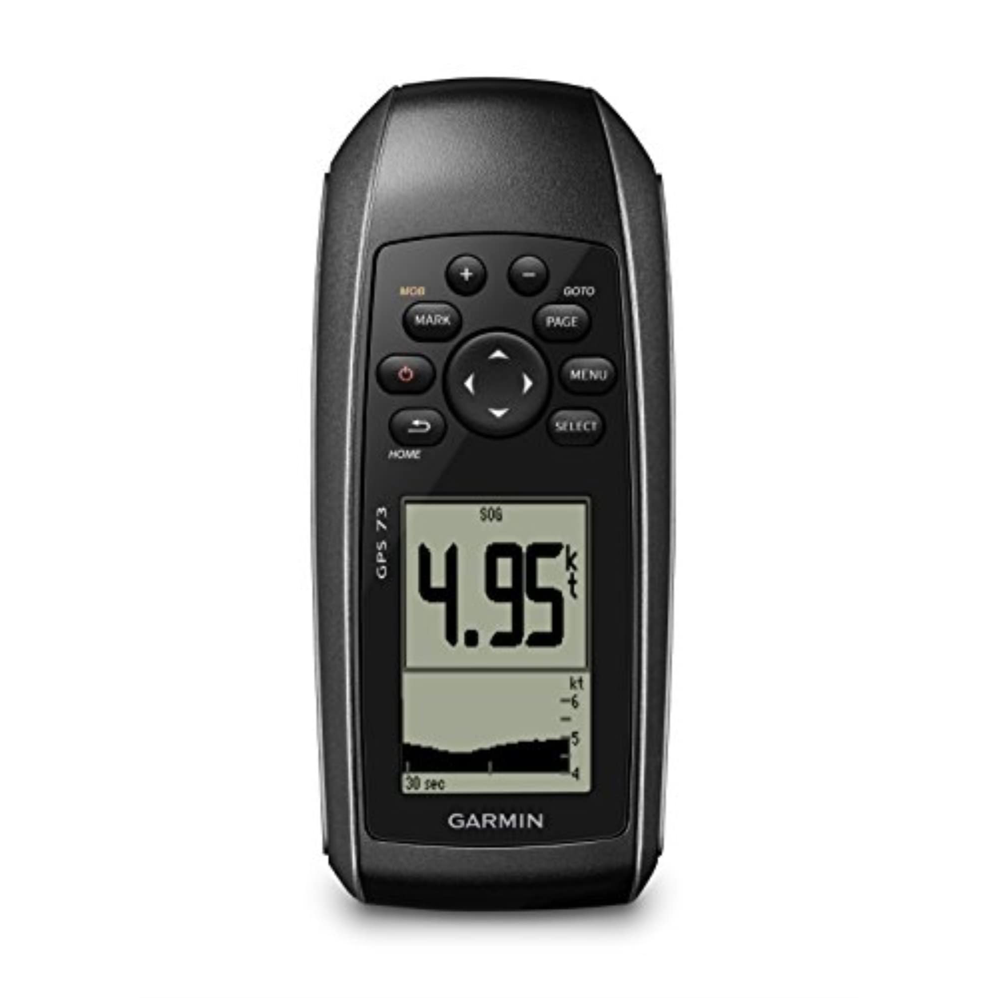
3. Garmin GPS 73 Handheld GPS
A marine-bred handheld that reads speed and course over open water.
The GPS 73 is built with boaters in mind, and you can feel it in the readouts: speed over ground, course over ground, and a point A-to-B track with progress and speed history. SailAssist adds a virtual starting line, countdown timers, speed history and tack assist. If your canoe trips happen on big lakes or tidal water where you want to know exactly how fast you are drifting against the current, that is genuinely useful data.
Battery is quoted at 18+ hours on two AA batteries. The dedicated backlit buttons are the other part that earns its keep on the water — cold, wet fingers find them without looking down. It stores up to 1,000 waypoints and 100 tracks, which is enough to keep favourite put-ins and take-out spots on file for years.
The honest trade-off is response speed. The unit updates its position on a set interval, and the default is slow enough that one user found it lagging between nearby locations during fieldwork. The fix is straightforward: you can set the update frequency, and a sailing owner reports dialling it to 3 seconds to save battery and steady the readout. The other thing to know is that this is a basic navigator, not a chartplotter — you get coordinates and course, not a detailed chart on screen. Pair it with a paper chart and the speed and course readouts do the rest.
What the button layout buys you: dedicated backlit keys and a non-color screen that stays readable at the helm — a combination that works with gloves on.
Know before you buy: it is a coordinates-and-course tool, not a screen full of chart detail, and the update interval needs adjusting to feel responsive.
Smart match for: lake, estuary and tidal paddlers who want speed and course data in a rugged marine body.
Pass on it if: you expect a moving map — this unit is about numbers, and the chart stays on paper.
4. Garmin eTrex 22x Handheld GPS Navigator
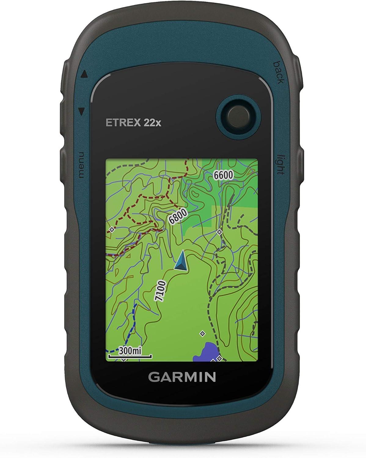
Routable topo maps from the start, without the premium price tag.
Here is the mid-tier answer to a simple question: what if I want real maps, not just a breadcrumb line? The eTrex 22x ships with TopoActive maps showing routable roads and trails, on a 2.2-inch sunlight-readable color display at 240 x 320 pixels. For a canoeist, routable trails matter at the portage and the put-in — you can see where the carry path actually goes instead of guessing from contour lines.
The battery figure is up to 25 hours in GPS mode on two AA batteries, which sits well above the 16-hour GPSMAP models and gives you a long shoreline day with margin to spare. It tracks GPS and GLONASS satellites, enough for most open-water and river work. Weighing in around 4.96 ounces, it disappears into a PFD pocket, and the non-slip body is comfortable to hold one-handed while the other hand keeps the paddle steady.
Two things to weigh honestly. First, there is an 8 GB internal memory plus a microSD slot for map downloads — the slot matters, because the shipped map data plus any additions fill that space quickly, and map updates are slow. Second, there is no 3-axis compass or barometric altimeter on this model; the compass only works while you are moving. The screen is small and the interface is dated, so if you want a big, bright panel you will be happier with the GPSMAP 64sx. For a short trip and a tight budget, though, this delivers maps that actually route.
Why it earns a spot
- TopoActive maps with routable roads and trails, preloaded
- Up to 25 hours in GPS mode on two AA batteries
- 8 GB internal memory plus a microSD card slot
- Light enough to live in a PFD pocket at around 4.96 ounces
Set expectations here
- No 3-axis compass or barometric altimeter — compass needs movement
- Small screen with a dated interface
- Map storage fills fast, so plan on a microSD card
Worth it for: day-trippers who want genuine topo maps and long AA runtime without premium spending.
Look further if: you need a compass that holds a bearing while you sit still — the 32x has that.
5. Garmin eTrex Solar Handheld GPS

A panel on the back turns a sunny float into an unlimited battery window.
This is the one designed for the long haul on open water. The maker states unlimited battery life when used in sunny conditions at 75,000 lux, and up to 200 hours with no solar charging at all. On a canoe you are outdoors in daylight by definition, so the panel keeps topping the cell up while you paddle. Owners describe charging it electronically once and then watching it stay charged indefinitely.
Multi-band GPS is the second headline. It listens on multiple frequencies from navigation satellites, which tightens positional accuracy compared with single-frequency GPS — the difference shows up when you are threading a narrow channel under tree cover. The digital compass holds a heading even when you are stationary, unlike older Garmin units where the compass demanded movement, and the 2.2-inch high-contrast display stays readable in direct sun. Pairing with the Garmin Explore app handles trip planning, weather, notifications and additional mapping.
The catch is maps. There is no full color topo on the device — you get a basemap and rely on your phone via the app for real map detail. If you paddle with no phone signal but want a proper map on the screen, that is a real limitation. On the plus side, the water-resistant IPX7 body shrugs off splashes and a dunk, and the low power draw means the battery worry largely disappears. Add a resin case and a carabiner; the body is described as slippery when wet.
The one-number story: 200 hours without sun, unlimited with it at 75,000 lux — a paddling season where the cell rarely needs a wall socket.
The honest negotiation: you trade on-device topo maps for that runtime, so a paired phone becomes part of the navigation plan.
Reach for this if: your trips are long, sunny and map-light, and you never want to think about charging.
Leave it on the shelf if: you need detailed topo maps visible on the device itself without a phone in the boat.
6. Garmin eTrex 32x Handheld GPS Navigator

Takes the 22x map package and adds the sensors a still canoe demands.
Set the 32x beside the 22x and the difference is two sensors: a 3-axis compass and a barometric altimeter. That sounds minor until you are sitting motionless in a canoe trying to work out which channel to take. A 3-axis compass gives you a heading while standing still — a moving compass cannot do that. The barometric altimeter reads elevation from air pressure, which helps confirm you are where the map says you are on a stepped river or a lake with rapids upstream.
You get the same core kit as the 22x tier. The 2.2-inch sunlight-readable color display at 240 x 320 pixels stays legible in direct sun, so you can read it on open water. Preloaded TopoActive maps include routable roads and trails, so you can follow a path to the put-in. There is 8 GB of internal storage plus a microSD slot, so you can add maps later. It runs up to 25 hours in GPS mode on two AA batteries, enough for a long day with spare cells in your pack. Satellite support covers GPS and GLONASS (two satellite networks that fix your position). In practice, the routing works for trails at the put-in, and the elevation plots give you a sense of the terrain before a portage.
Two practical notes. The screen comes across as small for detailed terrain work, and the microSD card sits loosely enough that some owners warn it can fall out — seat it carefully. The buttons and menus carry the usual Garmin learning curve. Among the eTrex line, this sits above the 22x for what a stationary paddler needs, but below the GPSMAP 64sx on screen size.
Why the extra sensors are worth it: a still-standing compass heading and a pressure-based altitude reading both solve problems that show up specifically when you are seated and drifting.
Small but real annoyance: the microSD card does not seat firmly — check it before you launch.
Right call for: paddlers who value a stationary heading and altitude alongside routable maps.
Skip the upgrade if: maps are all you need and you are happy with the 22x — the compass is the reason to spend more.
7. Garmin GPSMAP 79s Marine Handheld GPS

If the canoe tips, this is the one that bobs back up instead of sinking.
Design to float is the whole point here. A canoe is a stable boat right up until it is not, and a device that floats turns a fumble into a reach-down-and-grab. The body is water-resistant to IPX6 at the unit level, with a high-resolution color display and scratch-resistant, fogproof glass that keeps the screen clear when the spray settles.
You get plenty of room to store your trips: memory for 10,000 waypoints, 250 routes and 300 fit activities. It locks onto GPS, GLONASS, Beidou, Galileo, QZSS and SBAS satellites (six positioning networks that improve accuracy) — the broadest list in this shortlist alongside the eTrex SE. A worldwide basemap is included, so you have a starting map from the start. The 3-axis tilt-compensated compass holds a heading while you stand still, so you can check direction without walking. The barometric altimeter pinpoints altitude from pressure changes, so you can track climbs on a portage. Battery runs up to 20 hours in GPS mode.
The interface is where it asks work from you. There is no single quick “Go To” button — navigation runs through several menus, and adding waypoints is fiddly. It is a sturdy, capable tool that expects you to learn it before you need it. Plan a session on dry land with the manual so the menu path is muscle memory before you use it on the water. If you want a unit that survives a dunk and manages a coastal or big-lake route, this earns its place. If you want a screen you can tap through without reading a manual, look at the eTrex SE instead.
What makes it boat-ready
- Designed to float — a tipped canoe does not mean a lost unit
- IPX6 water resistance at the unit level
- Memory for 10,000 waypoints, 250 routes and 300 activities
- Up to 20 hours in GPS mode
A fair heads-up
- No quick start-navigation button — several menus deep
- Adding waypoints is fiddly
- Unit-level IPX6 rating, not a full-body submersible seal
Pick this when: losing a device over the gunwale is a real risk on your water.
Know first: the menu system needs practice before a trip, and the rating covers the unit body, not the battery bay.
8. Garmin GPSMAP 79sc Marine Handheld GPS

The 79s with coastal charts preloaded — for paddlers who work tide and shoreline.
The 79sc takes the floating GPSMAP 79s body and preloads BlueChart g3 coastal charts covering U.S. waters. If your canoe trips run along estuaries, tidal inlets or a coast where channels shift, those charts are the difference between guessing at the depth and reading it. It floats, it is water-resistant to IPX6 at the unit level, and the glass is scratch-resistant and fogproof.
Memory matches the 79s: 10,000 waypoints, 250 routes and 300 fit activities, and the satellite list covers GPS, GLONASS, Beidou, Galileo, QZSS and SBAS. The 3-axis tilt-compensated compass holds a heading while you are stationary, and the barometric altimeter reads altitude from pressure. Battery is up to 20 hours in GPS mode. Buyers report the 19-hour figure holding close to accurate in real use, though many would happily trade for 24 hours.
Two honest limits surface in owner feedback. The microSD card slot does not hold a card firmly, and some find it easiest to leave the preloaded coastal charts to work on their own rather than swapping in extra cards. The screen is small and non-touch, and the menu design is dated — expect an evening with the manual. There is also an undocumented round plug port that supports NMEA output to an autopilot, which is more feature than a canoeist needs but a nice bonus on a sail-and-paddle trip.
Where it beats the 79s above: preloaded BlueChart g3 coastal charts put tidal detail on the screen from the first launch.
Where both share a weakness: the microSD card retention and the dated, non-touch menu design.
Best suited to: coastal and tidal paddlers who want chart detail built in and a body that floats.
Not for you if: your water is inland lakes and rivers — the coastal charts add little, and the 79s keeps the floating benefits.
9. Garmin GPSMAP 65s Handheld GPS

Built for the places where a single-frequency fix starts to wander.
Multi-band technology is the reason to look here. It listens on more than one satellite frequency and pulls in an expanded set of global navigation systems, which holds accuracy in steep country, urban canyons and forests with dense trees. For a canoeist working a tight wooded channel or a cliff-shadowed bend, that is the exact failure point of a cheaper receiver — and this one is built to survive it. The 2.6-inch sunlight-readable color display is the same size as the GPSMAP 64sx, and the physical buttons are easier to hit with gloves on than a touchscreen.
Maps are preloaded TopoActive with routable roads and trails, plus a federal public land map for the U.S. The 3-axis compass and barometric altimeter cover the still-standing heading and the elevation reading. It manages tracks, routes and waypoints through the Garmin Explore app or website. Battery is quoted at up to 16 hours, matching the 64sx and trailing the 25-hour eTrex models — carry spares.
The clear split in owner experience is the interface. Users who sit down and configure it describe fast satellite acquisition, accuracy down to roughly 6 feet and a screen that reads well for its size. Others find the button scrolling tedious. Owners mention the multi-band accuracy holding up under cover, which is the whole reason to pay for this model over the 32x. Configure it thoroughly once on dry land and the multi-band fix becomes dependable on the water.
What the sensor package solves: fast acquisition and roughly 6-foot accuracy in the tree-heavy terrain that makes single-frequency units drift.
The cost of that accuracy: 16 hours of battery on AA cells — a short paddling day unless you carry spares — and menus that reward patience.
Worth it for: paddlers who work dense timber, steep banks or tight channels and need the fix to hold.
Not the pick for: long days far from spare batteries — the 25-hour eTrex models stretch further.
10. Garmin GPSMAP 86Sci Handheld GPS

Navigation with a satellite lifeline — for water far beyond cell coverage.
This is the one for a wilderness canoe route where a handheld is also your emergency plan. inReach satellite communication and two-way text messaging run over the Iridium network (a satellite network that works where cell signal does not). With a satellite subscription you can trigger an interactive SOS to a 24/7 search and rescue centre, or share your location with someone at home. That capability separates it from every other pick here, none of which can send a message. If you paddle only within cell coverage and never need to call for help, skip the subscription and pick a simpler unit.
The rest is built for water. It floats, it carries a sunlight-visible 3-inch display — the largest in this group — and preloaded BlueChart g3 coastal charts. The adjustable GPS filter smooths speed and heading over swells, which helps when the canoe is riding chop. It works as a remote control for a Garmin autopilot and Fusion Marine products with free apps. Battery is up to 24 hours, and customers note it barely sipping 10% over three hours of use.
The honest caveats are the satellite subscription and the maps. Satellite features need a paid plan, which some owners find fiddly to set up. Preloaded charts can be dated from the start, and one owner reports the Garmin Express update is a paid upgrade rather than a free refresh — so budget for map updates as part of ownership. Treat the subscription and map costs as the real entry ticket, and the messaging and SOS capability is the reason to accept it.
The headline capability: two-way satellite messaging and an SOS trigger to a 24/7 rescue centre — the only pick here with a literal lifeline.
Budget for more than the device: a satellite subscription is required for the messaging, and map updates can cost extra.
Choose this if: your route runs beyond cell coverage and you want a way to call for help.
Weigh the ongoing cost: the satellite plan and paid map updates add up, so this is for the paddler who needs the lifeline.
11. Garmin eTrex 10 Worldwide Handheld GPS
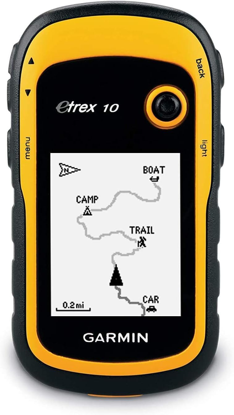
The simplest way to keep a breadcrumb trail home without spending much.
If you only need to mark your put-in, follow a track out, and find your way back to the vehicle, the eTrex 10 covers exactly that and nothing more. It runs on two AA batteries for up to 20 hours, so a spare pair in the dry bag covers a full day and then some. It is waterproof to IPX7 standards, which handles rain, splash and a dunk. It supports GPS with HotFix and GLONASS for fast positioning, and it takes a WAAS-enabled receiver for tighter accuracy.
What you do not get is a color screen or loadable maps. The 2.2-inch display is monochrome, with no microSD card slot, so the basemap is minimal and there is nowhere to add topo detail. Navigation works from GPX breadcrumb tracks and waypoints — you follow the line, not a map. For a linear river with a clear put-in and take-out, that is enough. For a lake full of branching bays, the lack of a map will cost you time.
The build gets plenty of credit, and rightly so — it takes field conditions, cold, rain, mud and drops, and keeps working. The usability and the included instructions are the weak spot: menus are not intuitive and the printed guidance is thin. Expect a learning curve, especially for programming a route. As a first handheld or a backup in the bottom of a pack, it marks waypoints and follows a breadcrumb track.
What the low entry gets you
- Up to 20 hours on two AA batteries
- IPX7 waterproof body that takes field abuse
- GPS with HotFix and GLONASS for fast positioning
- Paperless geocaching and simple waypoint marking
The trade-offs built in
- Monochrome 2.2-inch screen with no color
- No microSD slot, so no loadable maps
- Menus and instructions are not intuitive
Good fit for: a first handheld, a backup unit, or a simple out-and-back river run.
Not enough for: map-driven navigation on a branching lake — you will want the eTrex 22x for that.
Know the Specs
Battery Life and AA Power
Battery life on a canoe GPS is usually quoted in GPS mode, meaning the receiver is actively tracking. A figure of 16 hours covers a long paddling day; 25 hours gives you margin for a dawn start and a dusk finish; 168 hours in standard mode covers a multi-day trip. Expedition mode stretches runtime further by sampling position less often. AA cells matter because you can swap them in seconds without an outlet, so pack a spare pair in a dry bag and the runtime question stops being a worry.
IP Ratings and Floating Bodies
An IPX7 rating means the unit survives a short submersion in water — enough for rain, spray and a dunk. An IPX6 rating covers powerful water jets at the unit level, but not full submersion of every part. Floating is a separate design property: a body built to float stays on the surface if it goes over the side. For a canoe, the safest pairing is water resistance plus a floating body, so a fumble becomes a quick reach-down rather than a loss.
Multi-GNSS and Multi-Band
Multi-GNSS support means the unit listens to several satellite constellations — GPS, GLONASS, Galileo, BeiDou and QZSS — so it has more satellites to choose from when the sky is partly blocked. Multi-band adds a second frequency for tighter positional accuracy. On open water, standard GPS is usually enough; in a tree-lined channel or a steep valley, the extra signals keep the fix from dropping.
Compass and Altimeter
A 3-axis compass gives a heading while you are standing still, which a movement-dependent compass cannot do. That matters in a drifted canoe where you want to check your bearing before you paddle. A barometric altimeter reads elevation from air pressure, giving a stable altitude to confirm your position against a map. Not every model includes both, so check the listing if a stationary heading is important to you.
Common Questions
Will a handheld GPS still work on a river with no cell signal?
Does an IPX7 rating mean the GPS will survive a tipped canoe?
How many hours of battery do I actually need for a canoe day?
Can I load my own topo maps onto these handhelds?
Is multi-band GPS worth it for a canoeist?
Do I need a compass on the GPS if I already carry a boat compass?
What happens to the GPSMAP 86Sci if I stop paying for the satellite plan?
Will the GPSMAP 79s and 79sc float with batteries installed?
Can these handhelds send a help signal when I am out of cell range?
Is a bigger screen worth it on a canoe GPS?
The Bottom Line
For most canoeists, the gps for canoeing that balances screen, sensors and a proven build is the Garmin GPSMAP 64sx. Its 2.6-inch sunlight-readable color display stays clear in bright light, so you can read it on open water. A quad helix antenna (a coiled antenna that grabs signal better) holds a fix under tree cover, so you keep your position in the woods. A true 3-axis compass keeps a heading when you are sitting still. If your trips run long enough that charging becomes a planning problem, the Garmin eTrex SE answers it with 168 hours in standard mode on AA cells, so a multi-day trip needs no charger. And for a route that takes you beyond cell coverage, the Garmin GPSMAP 86Sci is the pick that floats and can call for help.
How we choose
We do not accept paid placement. Every pick is matched to a real buyer and a real use-case; we do not hands-on test units.
Sources
Specifications: manufacturer listings and product documentation. Review insights: verified customer reviews, as of October 2026. Pricing: not shown on this page (it changes often); check the current price via the retailer link.
As an Amazon Associate, Aappliancez earns from qualifying purchases. This does not affect which products we feature.